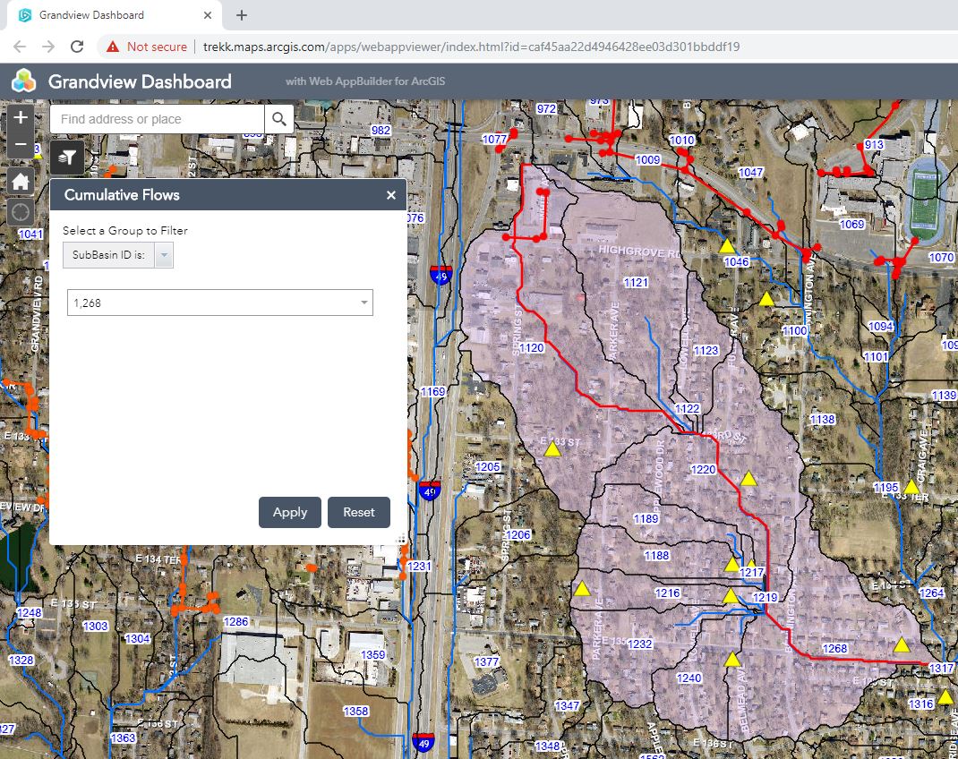
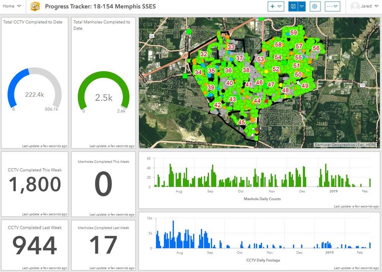
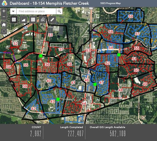
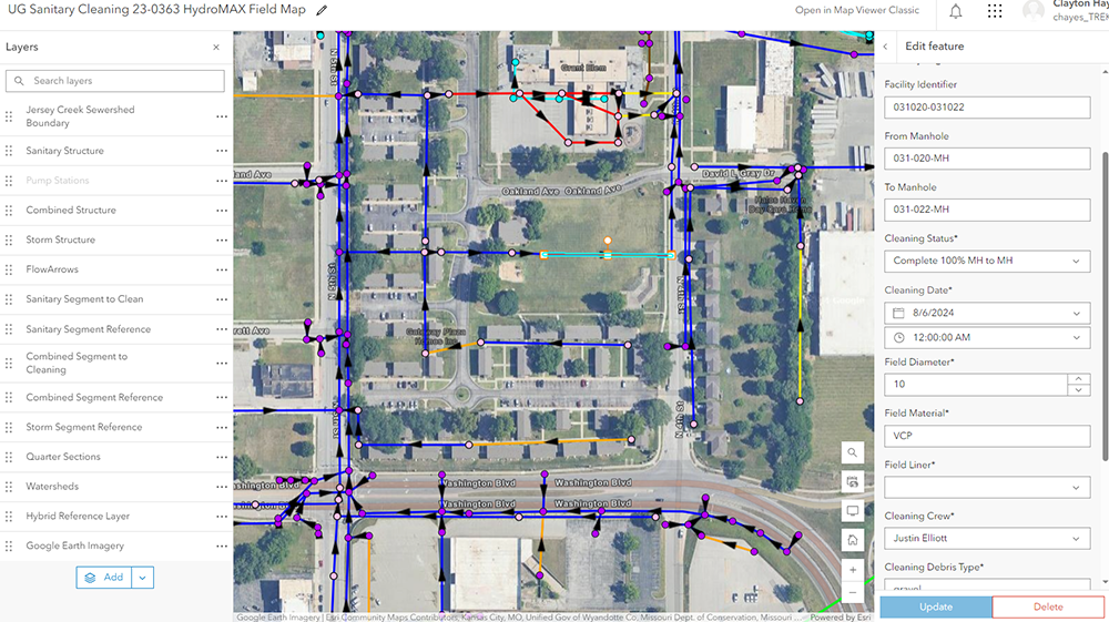
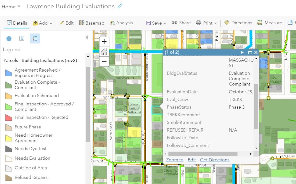
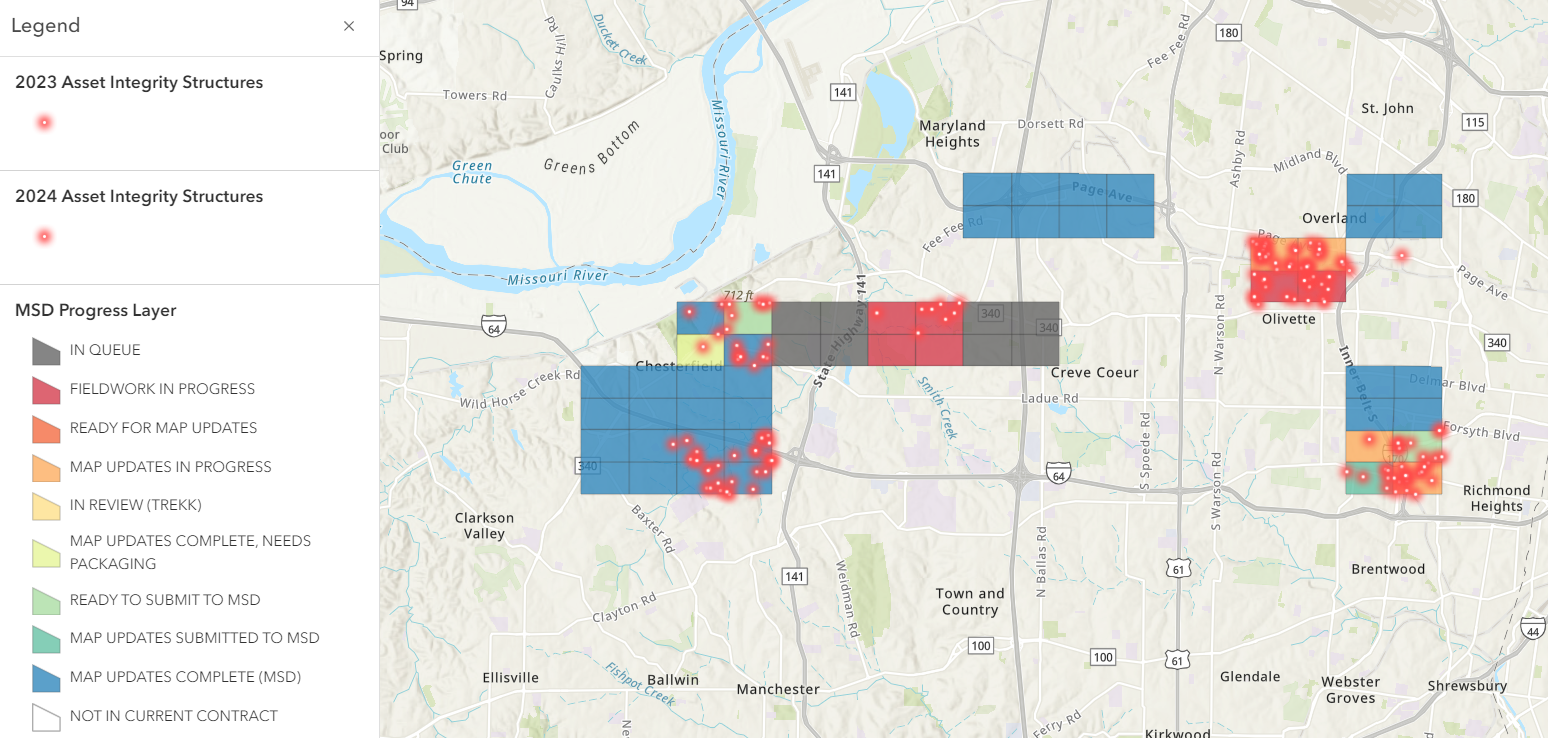
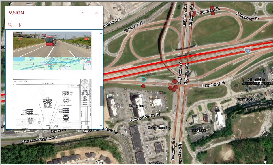
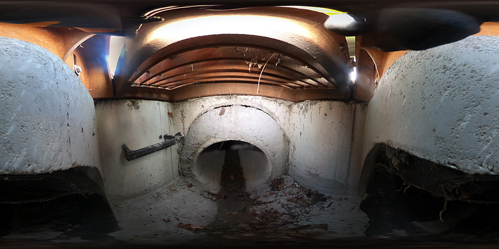
TREKK’s experts understand the balance cities and utilities must find between maintaining failing infrastructure, achieving regulatory compliance and meeting budget constraints. Harnessing the power of GIS data, we help our clients understand the location and condition of their assets, including sanitary and storm sewer, water and electrical infrastructure; traffic signals; streetlights; and roadway signage. We can then use this data to identify failure modes, rate risk levels, prioritize and establish maintenance plans and develop long-term funding strategies. Our asset management planning focuses on achieving the greatest return, maximizing the value of our clients’ existing platforms and data while providing the best possible service to their users.
We use GIS to provide enhanced analysis and improved visual renderings for a variety of planning needs. Working hand-in-hand with our field technicians, our GIS analysts take field data and seamlessly integrate it into existing GIS and asset management systems. We also help communities develop customized GIS and mapping systems tailored to meet their needs. TREKK offers asset management database development and assistance with software implementations to support these applications for our clients.