Managing a stormwater system requires balancing financial resources and physical system needs based on available data. The city of Lawrence’s enclosed stormwater system serves nearly 100,000 residents and includes 280 miles of stormwater conveyance and more than 17,600 structures, which collect stormwater over nearly 35 square miles. While the city had an idea of its stormwater assets and locations, it wanted a more accurate inventory of these assets and their condition to develop a strategic Capital Improvement Plan (CIP) to rehabilitate the system, address flooding issues and meet regulatory requirements.
The Stormwater System Identification, Assessment and Modeling project is an innovative approach to identifying the condition, criticality and serviceability of stormwater assets. The project standardizes and modernizes how data is collected, assessed, stored and used while establishing a framework to help better understand the location and condition of the stormwater assets and facilitate comprehensive capital planning efforts.
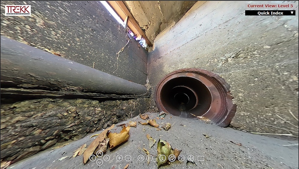
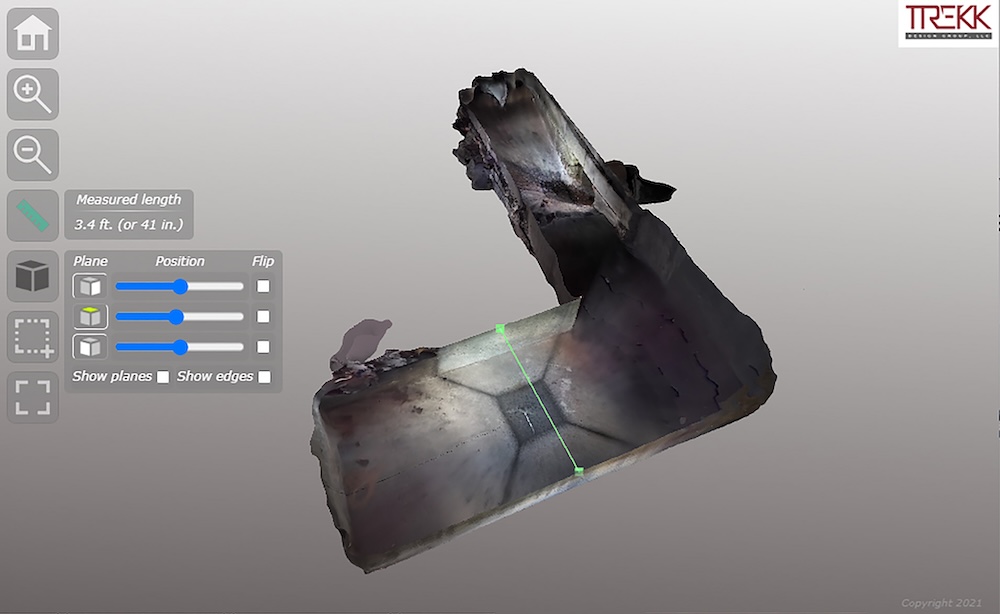
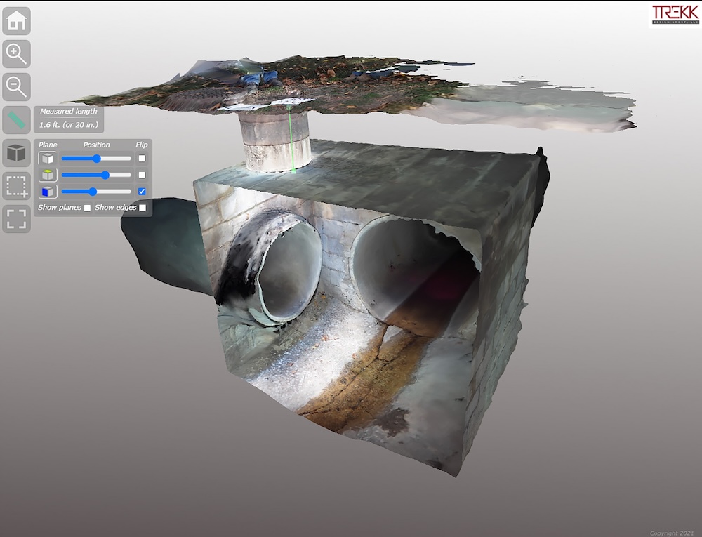
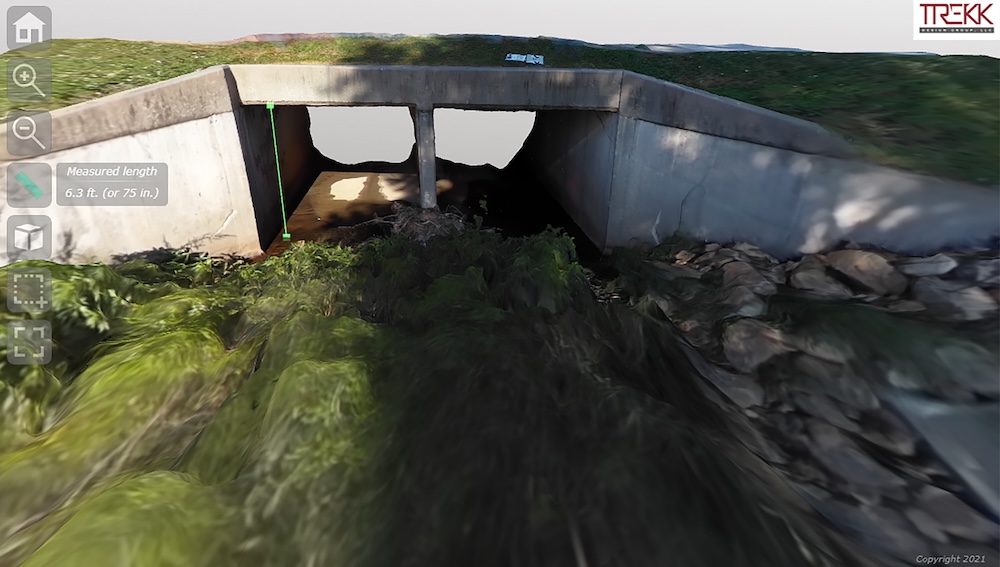
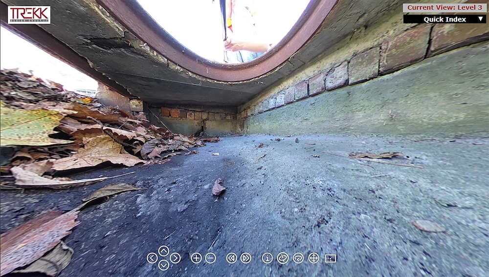
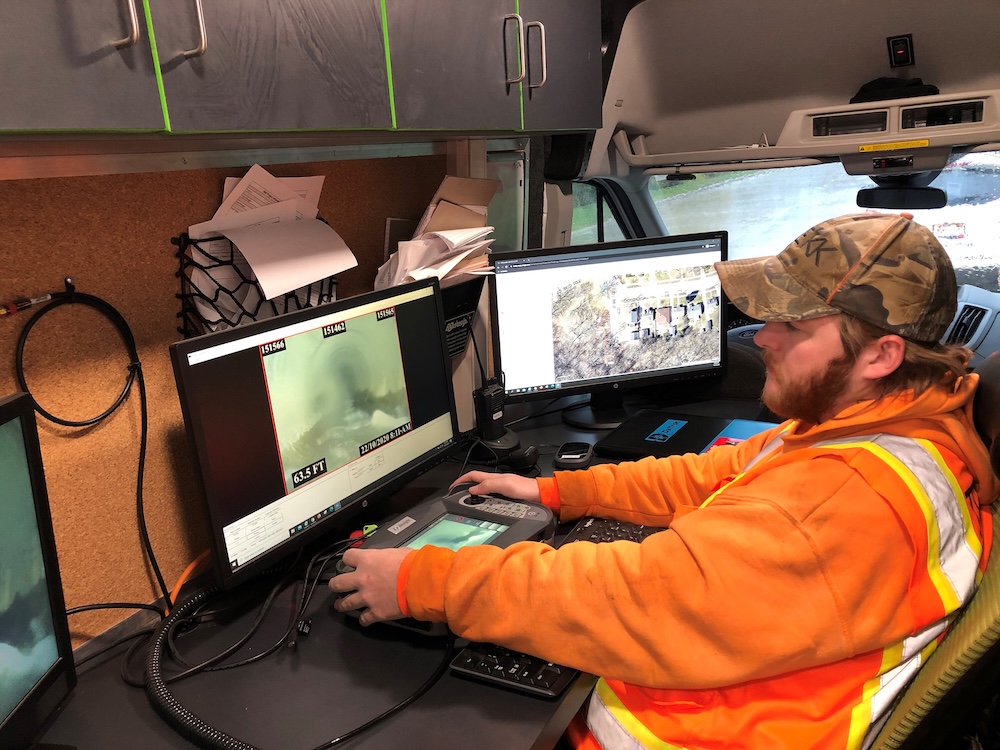
Crews from both TREKK and Lawrence collect data on storm structures and pipes in the field using CCTV and the innovative TREKK360 camera. TREKK360 provides 360-degree quality visuals for accurate condition assessments without requiring confined space entry, helping field crews work smarter, faster and safer. As part of the TREKK360 capture process, 3D models of every structure can also be generated, which provides better data for planning and risk assessment purposes.
Using a 360-degree camera system also allows field crews to deliver more information via pictures and videos for modeling purposes, even in difficult structures. By using this innovative technology, field crews have safely and efficiently inspected and assessed more than 11,000 structures and provided CCTV on more than 600,000 linear feet of storm pipe to date.
Collected data is housed in an ArcGIS Utility Network platform and given a Business Risk Evaluation Score to help prioritize asset evaluations and aid in the city’s corridor approach to infrastructure repairs.
This data, along with advanced stormwater modeling and modernized stormwater design criteria, is helping Lawrence identify cost-effective solutions and develop a more finely tuned and economically targeted CIP to rehabilitate the system, reduce localized flooding issues and contribute to environmental sustainability.